DEPRIMAP Poster presentation at the Flood Risk Conference
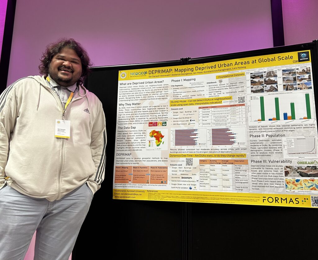
At the Flood Risk Conference 2025 at Karlstad University, Sai Ganesh Veeravalli presented a poster titled ‘DEPRIMAP: Mapping Deprived Urban Areas at Global Scale‘, showcasing the ongoing research from the project.
Summary
The poster summarised the core vision of DEPRIMAP: developing globally consistent, geospatial methods to map and understand deprived urban areas (DUAs) – neighbourhoods where inadequate infrastructure and limited access to services increase exposure to environmental hazards. It outlined the three research phases of the project:
- Mapping: Detecting deprived areas using interpretable indicators from open geospatial data.
- Population: Improving estimates of people living in DUAs, addressing the chronic undercounting in existing datasets.
- Vulnerability: Linking DUA maps with hazard data (floods, heatwaves, landslides etc) to identify who is most exposed but least represented in planning.
As part of Phase I, two key research papers that were recently published were presented: the ISLAND Model, which uses six indicators to map DUAs across multiple cities, and a temporal analysis using Google’s 2.5D building data that revealed how informal settlements in Nairobi are expanding both horizontally and vertically. A sneak peek of what phase II and III could comprise was also presented in the poster.
Participating in the conference was an opportunity to connect DEPRIMAP’s global-scale work with conversations on urban resilience, risk governance, and sustainable adaptation, emphasising that understanding where and how people live is fundamental to addressing climate risks equitably.
Acknowledgements
Sai Ganesh thanks the Centre for Societal Risk Research (CSR) for the financial support for attending the conference.
No responses yet