Workshop Reflections: Mapping Poverty and Population in an Era of Data Uncertainty
Date: April 09, 2025
Location: George Washington University, United States of America & Zoom
On April 9, 2025, DEPRIMAP team members attended the Member-Initiated Meeting on Poverty and Population Mapping at the Population Association of America (PAA) conference in Washington, DC. Titled “Novel Approaches to Poverty and Population Mapping Using Remote Sensed and Socioeconomic Data” the workshop brought together an inspiring community of researchers, data scientists, policy professionals, and urban planners to discuss a pressing and timely issue: how do we map poverty and population in a world where traditional data systems are in crisis?
The workshop, hosted at George Washington University, was more than just a technical gathering. It served as a call to action in the face of declining international support for household surveys and national censuses – datasets that form the backbone of democratic planning, evidence-based policy, and equitable resource allocation. As highlighted in the opening notes, more than 100 countries rely on external funding to carry out these large-scale data efforts. With key programs like USAID’s DHS program recently terminated and others (such as UNFPA and UNICEF) facing cuts, national statistical systems – especially across Africa and Asia – are being forced to rethink how they collect and maintain population data.
In this challenging context, the workshop posed critical questions:
- Can non-traditional data sources, such as remote sensing and geospatial datasets, fill the void left by failing survey infrastructure?
- What governance models, financing mechanisms, and data communities are needed to support cities in building trustworthy and locally relevant data systems?
- And most urgently – how do we ensure that the most vulnerable populations are not rendered invisible in the absence of regular and granular data?
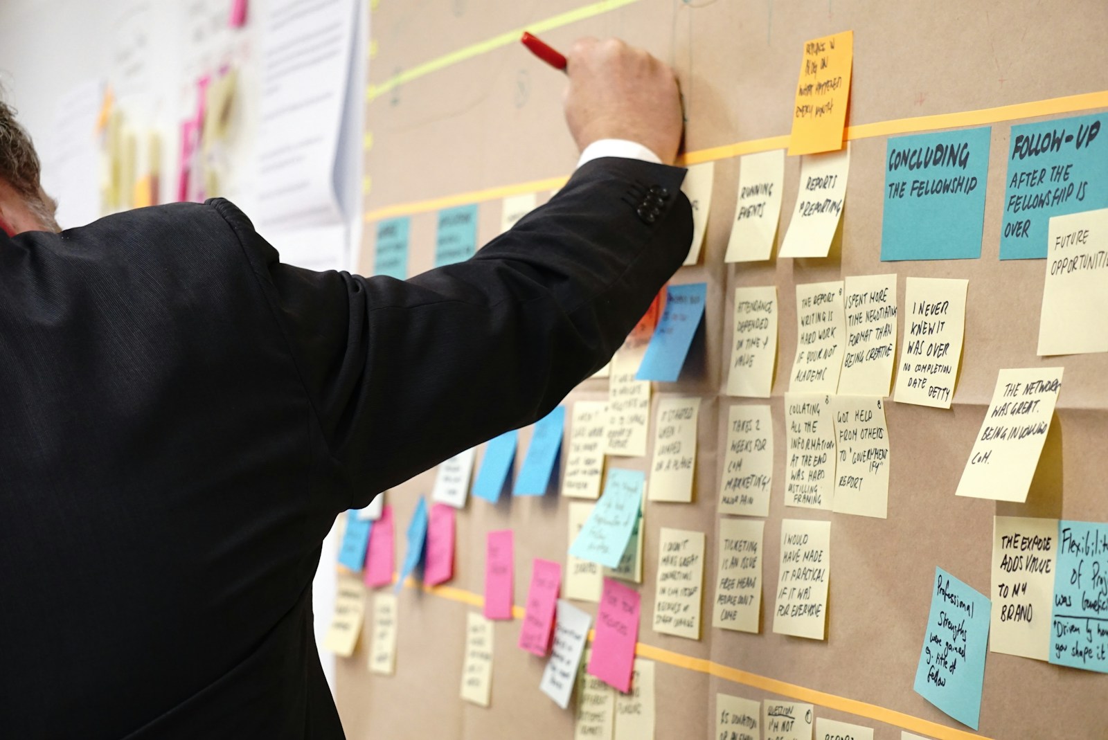
The agenda featured a series of speaker expos, discussions, and open debates around urban poverty, spatial data needs, global mapping innovations, and the crisis of censuses and surveys. It provided space not just to showcase technological advances but also to reflect critically on data equity, inclusion, and sustainability in a rapidly urbanizing world.
In the next sections, we will walk through some of the key presentations and ideas shared during the day, offering reflections relevant to our in DEPRIMAP, especially around mapping deprivation, enhancing resilience, and integrating remote sensing into urban research.
Session 1 – Urban Poverty Geospatial Data Needs
The opening session of the workshop brought together diverse perspectives from urban researchers, community leaders, and data scientists. Each speaker emphasized the importance of inclusive, high-resolution, and actionable geospatial data for addressing urban poverty and inequality.
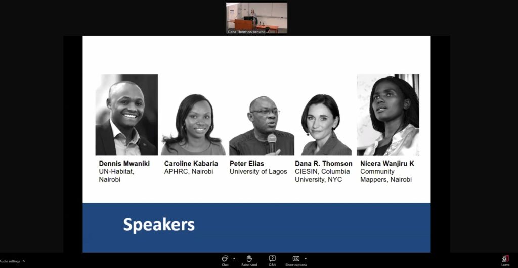
Dennis Mwaniki (UN-Habitat, Nairobi)
Dennis opened the session by framing the importance of spatial data in tracking SDG 11.1. He highlighted persistent gaps in identifying and monitoring slums and informal settlements, proposing a multi-scale mapping framework that combines Earth Observation (EO), localized data, and high-resolution community inputs to better reflect the complexity and informality across urban landscapes.
Caroline Kabaria (APHRC, Nairobi)
Caroline focused on the challenges local governments face in gathering, managing, and using urban data – especially in under-resourced departments. She emphasized that sustainable development planning requires strong institutional capacity and cross-sector collaboration, particularly with housing and infrastructure departments.
Nicera Wanjiru K (Community Mappers, Nairobi)
Bringing a powerful grassroots voice, Nicera underscored the agency and knowledge that communities already hold. She advocated for participatory mapping and emphasized that ‘information is power’, especially in underserved settlements. Her call was clear: include communities not just as data sources but as co-produces of solutions, and the data generated is ethical and transparent in nature.
Dana Thomson Browne (CIESIN, Columbia Unversity)
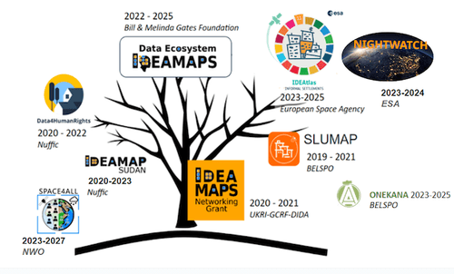
Dana introduced the IDEAMAPS Network and the ‘Double Loop+’ co-production process, which brings together communities, governments, and data scientists. Her talk stressed that mapping tools should serve multiple users – from local governments to global agencies – and must be built through inclusive, trust-based processes.
Peter Elias (University of Lagos)
Peter provided a critical scientific perspective on Global North-South research inequalities. He argued for locally driven innovation and proposed a roadmap for more balanced data ecosystems: co-designed research, investment in local data infrastructure, and open access systems that foster long-term impact beyond donor timelines.
Alex de Sherbinin (CIESIN, Columbia University)
Alex presented the technical foundations of the Global Gridded Relative Deprivation Index (GRDI), now in version 1.10. He detailed its six input components (CDR, IMR, SHDI, BUILT, VNL 2020, Slope), and the spatial indexing and weighing methodology that allows it to map deprivation globally at approximately 1km resolution.
Kamwoo Lee (World Bank, United States of America)
Kamwoo shared the World Bank’s High-Resolution Wealth Index mapping work across Sub-Saharan Africa. Using both feature-based (e.g., OSM roads, buildings, POIs) and image-based (CNN) models, their approach enables wealth index estimation at the village level – filling gaps where household surveys like DHS lack GPS coordinates.
Link to the paper: High-Resolution poverty maps in Sub-Saharan Africa
Session 2 – Methods and Models for Mapping Informality
This session brought together technical leaders from the IDEAMAPS and IDEAtlas communities, presenting diverse approaches to modelling urban informality and socio-economic vulnerability. Emphasis was placed on scalable, open-source, and user-driven AI methodologies that integrate satellite imagery, contextual features, and participatory data to support SDG monitoring and equitable urban development.
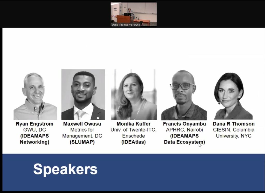
Maxwell Owusu (Metrics for Management / SLUMAP Project)
Maxwell presented the SLUMAP (InvisibleSPACE) initiative, a part of the IDEAMAPS Network. His presentation focused on EO-based slum typologies, drawing from foundational work by Sliuzas et al. (2018) and Kohli et al. (2012). He outlined a classification of informal settlements into four types – Mature, Consolidated, Infant, and Kiosk Estate – based on roof density, material permanence, road infrastructure, and spatial proximity to city centres or industrial zones. Maxwell then introduced a two-step hybrid mapping framework:
- Step 1: Data-driven slum mapping using global morphological features.
- Step 2: User-driven refinement through field observations, interviews, and participatory validation to ensure geo-ethical and locally relevant outputs. The project champions a ‘user-driven EO mapping’ vision, advocating for the integration of remote sensing with localized knowledge to improve classification accuracy and support community-accepted mapping outcomes.
Link to the paper: Towards user-driven earth observation-based slum mapping (Stefanos Georganos from DEPRIMAP is one of the co-authors of this work)
Monika Kuffer (University of Twente, ITC)
Monika presented the IDEAtlas project, a user-and data-centric AI model designed to map informal settlements at scale. Her talk showcased the integration of Sentinel-1 and 2, PlanetScope, and high-resolution population data using multi-stream FCN (Fully Convolutional Network) architectures. The platform’s Living Lab approach ensures local relevance and stakeholder engagement across pilot and expansion cities. Future plans include knowledge transfer to Mumbai, Guinea-Bissau, and Colombia, and upscaling efforts in Argentina. Monika also emphasized the importance of morphology and temporal dynamics in producing slum severity indices and city-scale metrics aligned with SDG 11.1.1.
Ryan Engstrom (George Washington University)
Ryan introduced scalable machine learning workflows to map both binary deprived areas and ranges of deprivation. Using contextual features like Line Support Regions, NDVI, and Fourier Transforms, the models operated at 100m grid scale using Sentinel-2 data. He highlighted key challenges such as inconsistent definitions of deprivation across cities, noisy feature inputs, and the difficulty in generating reliable training data for continuous informality levels. Ongoing work focuses on improving signal quality and testing models across multiple urban contexts.
Dana Thomson Browne (CIESIN, Columbia University)
Dana presented ongoing work on classifying city segments by socio-economic status (SES) vulnerability, building a scalable global framework for vulnerability mapping. These segments maintain minimum population thresholds to preserve anonymity and are designed to be functionally similar to census enumeration areas, while linking closely to conceptual frameworks of vulnerability. A key strength of the approach is its interpretability and contextual sensitivity – with vulnerability measured relative to national or city-level medians.
However, Dana noted that these relative indicators are not directly usable for SDG 11.1.1, which requires absolute measures. In response, ongoing efforts are now focused on developing absolute SES vulnerability indicators, with testing across 8 diverse cities to examine correlations with field-referenced slum areas.
This specific task is being led by two researchers, including Sai Ganesh Veeravalli from the DEPRIMAP project, contributing to the IDEAMAPS Network’s goal of producing actionable, equitable urban vulnerability datasets.
Session 3 – Addressing the Population Data Crisis
This closed-door discussion focused on the rapidly escalating global population data crisis, particularly the collapse of international support for country-led censuses and surveys. With the termination of programs like USAID’s DHS and looming cuts to UNFPA and UNICEF, the session explored how national statistical offices (NSOs) – especially in low-resource settings – can adapt to fill these critical data gaps. Presentations by Dana Thomson and Jessica Espey from University of Southampton (POPGRID) set the stage, highlighting urgent needs and promising pathways, including the integration of geospatial and non-traditional data for population estimation. The conversation included contributions from several key players in the field, underscoring the pressing need for new financing models, technical innovation, and governance structures to ensure reliable population data for planning, policy, and the Sustainable Development Goals (SDGs).
A very relevant article on this issue: Global population data in crisis – here’s why that matters
Concluding Remarks
The workshop underscored a shared urgency among researchers, practitioners, and data producers to build more inclusive, resilient, and scalable systems for mapping urban poverty and population dynamics. Across all sections, participants highlighted the central role of high-resolution, community-informed, and methodologically transparent data in addressing challenges in urban planning, service delivery, and SDG monitoring.
Session 1 emphasized the need for localized geospatial data ecosystems, where city governments, communities, and researchers co-produce knowledge to tackle informality and inequality. In Session 2, cutting-edge technical methods – ranging from AI-driven slum mapping to SES vulnerability modelling – showed promising advances, yet also revealed the importance of ethics, user-centred design, and field validation. Finally, Session 3 raised an alarm over the global crisis of censuses and surveys, as international funding support erodes, pressing the need for innovative partnerships and alternative data strategies to uphold demographic and development planning across the Global South.
Together, these discussions called for a shift from siloed efforts towards a coordinated global urban data ecosystem – one that leverages Earth Observation, field data, participatory tools, and institutional capacity to support equitable development and climate resilience in the world’s fastest growing cities.
Slides, recordings, and speaker summaries here:
https://sites.google.com/ciesin.columbia.edu/poverty-and-population-mapping/home
No responses yet